


ANRA AWARE
Free, Browser-based Airspace Intelligence for Safer Drone Operations
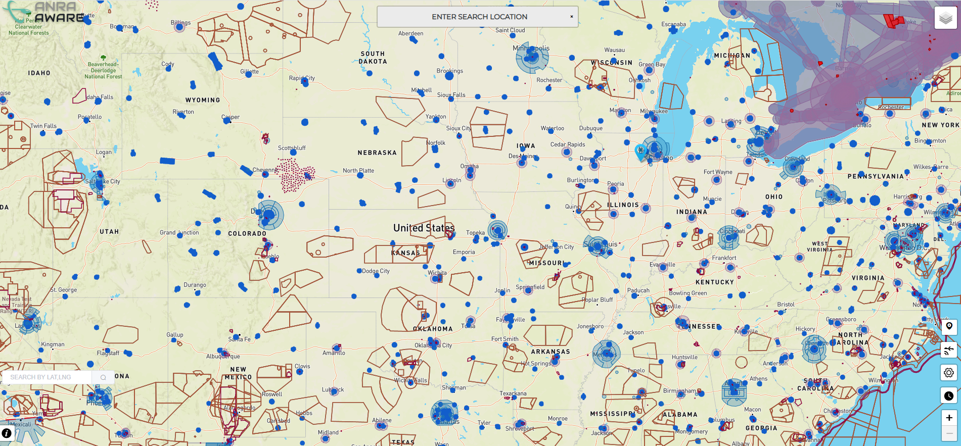
AWARE is ANRA Technologies’ free online tool that gives users a unified, global view of relevant airspace information and advisories. Powered by the same certified technology behind ANRA’s U-space and UTM platforms, AWARE helps operators understand where, when, and how to fly safely before a drone ever leaves the ground.
- International coverage
- Advisories & constraints for informed decision-making
- No download needed—runs in any browser
- Completely free
- Multiple data overlays that are available depending on your region
Note: AWARE is advisory only and does not replace required regulatory approvals. You can contact us for additional value-added services like LAANC, UTM, Uspace.
Who Is AWARE For?
AWARE supports a wide range of users who need fast, visual airspace understanding:
- Commercial & enterprise operators – Pre-plan missions and brief teams.
- Public safety & government agencies – Gain quick situational awareness for planning and coordination.
- ANSPs, regulators & policy leaders – Explore modern digital airspace capabilities.
- Academia & researchers – Use as a teaching and exploration tool.
- Enthusiasts & ecosystem partners – Follow the evolution of drone and AAM airspace management.
Key Capabilities
1. Global Airspace View
Interactive map-based interface to explore international airspace.
2. Advisory Information & Constraints
View alerts, caution areas, operational considerations, and other contextual insights that support safe flight planning.
3. Support for Risk Assessment
AWARE helps inform:
- Operational risk assessments
- Route and contingency planning
- Mission documentation and briefings
4. Powered by Certified Infrastructure
AWARE runs on ANRA’s production-grade digital airspace technology stack used for U-space, UTM, and shared airspace initiatives, bringing operational credibility to every user.
How It Works
- Go to: https://aware.flyanra.net/
- Choose a location: Pan, zoom, or search; double-click to view advisories.
- Toggle layers & insights: Explore constraints and contextual information.
- Apply insights: Use the information to guide planning and risk assessments.
ANRA is making it part of its proven digital airspace capability freely accessible to:
- Reduce barriers to safe drone operations
- Support industry growth and education
- Demonstrate the value of modern airspace services for drones and AAM
- Better awareness leads to better decisions and safer skies.
What’s Next
AWARE will continue to evolve with:
- Additional data layers and contextual insights
- Enhanced advisory logic
- Deeper integration with ANRA’s Mission Manager X (MMX) and U-space/UTM services
To learn how ANRA can support your operations, contact us at sales@flyanra.com.